|
Welcome,
Guest
|
TOPIC: Tracking The Eye, 2011
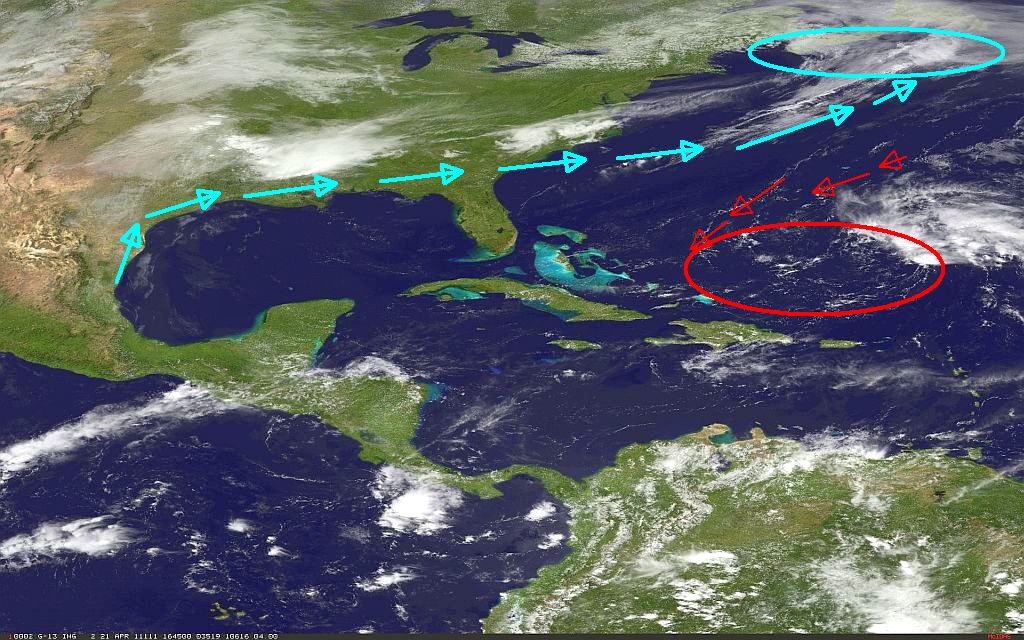
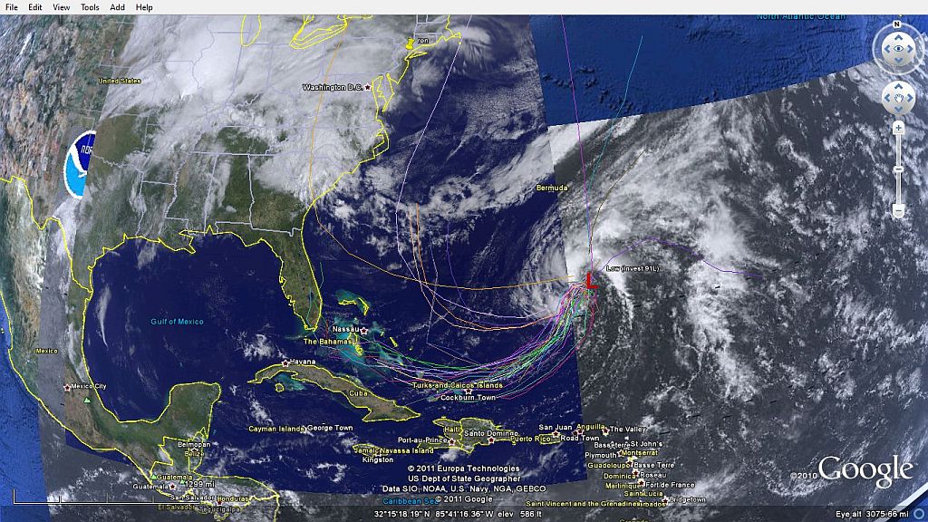
Tracking The Eye, 2011 15 years 1 month ago #30353
|
Please Log in or Create an account to join the conversation. |


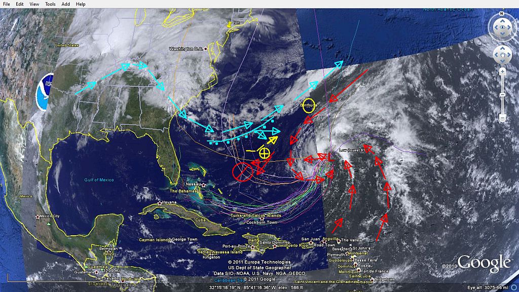
Re:Tracking The Eye, 2011 15 years 1 month ago #30363
|
|
Please Log in or Create an account to join the conversation. |
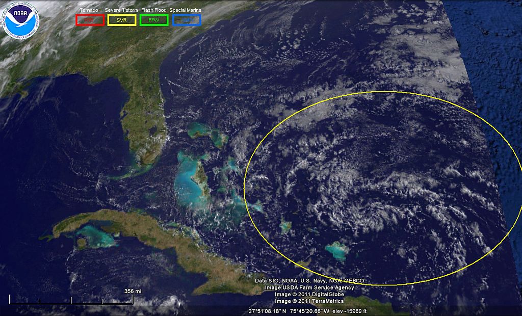
Re:Tracking The Eye, 2011 15 years 1 month ago #30364
|
Please Log in or Create an account to join the conversation.
Mark
|
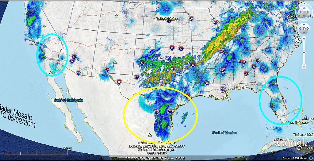
Re:Tracking The Eye, 2011 15 years 1 month ago #30367
|
|
Please Log in or Create an account to join the conversation. |

Re:Tracking The Eye, 2011 15 years 1 month ago #30369
|
Please Log in or Create an account to join the conversation.
Mark
|
Re:Tracking The Eye, 2011 15 years 1 month ago #30374
|
Please Log in or Create an account to join the conversation. |
Re:Tracking The Eye, 2011 15 years 1 month ago #30376
|
Please Log in or Create an account to join the conversation. |

Re:Tracking The Eye, 2011 15 years 1 month ago #30378
|
|
Please Log in or Create an account to join the conversation. |
Re:Tracking The Eye, 2011 15 years 1 month ago #30383
|
|
Please Log in or Create an account to join the conversation. |
Re:Tracking The Eye, 2011 15 years 1 month ago #30422
|
Please Log in or Create an account to join the conversation. |
Re:Tracking The Eye, 2011 15 years 1 month ago #30463
|
Please Log in or Create an account to join the conversation. |


Re:Tracking The Eye, 2011 15 years 1 month ago #30484
|
|
Please Log in or Create an account to join the conversation. |


Re:Tracking The Eye, 2011 15 years 1 month ago #30531
|
Please Log in or Create an account to join the conversation. |
Re:Tracking The Eye, 2011 15 years 1 month ago #30536
|
Please Log in or Create an account to join the conversation. |
Re:Tracking The Eye, 2011 15 years 1 month ago #30600
|
Please Log in or Create an account to join the conversation. |


Re:Tracking The Eye, 2011 15 years 1 month ago #30642
|
Please Log in or Create an account to join the conversation. |
Re:Tracking The Eye, 2011 15 years 1 month ago #30655
|
|
Please Log in or Create an account to join the conversation. |
Re:Tracking The Eye, 2011 15 years 1 month ago #30674
|
Please Log in or Create an account to join the conversation. |
Re:Tracking The Eye, 2011 15 years 1 month ago #30691
|
Please Log in or Create an account to join the conversation. |
Re:Tracking The Eye, 2011 15 years 1 month ago #31243
|
Please Log in or Create an account to join the conversation. |


Re:Tracking The Eye, 2011 15 years 1 month ago #31340
|
Please Log in or Create an account to join the conversation. |

Re:Tracking The Eye, 2011 15 years 1 month ago #31599
|
Please Log in or Create an account to join the conversation. |

Donate
Please consider supporting our efforts.
Glassified Ads
1959 Perormer Sportsman |

17' Fiber Form Bowrider Bailrider I-O Boat & EZ Load Trailer( / Boats)


Family Owned 1961 Glasspar Seafair Sunliner 18’( / Boats)


FG Login

FiberGoogle
Who's Online
We have 8386 guests and no members online