|
Welcome,
Guest
|
TOPIC: Houston's thread for hurricanes?
Re:Houston's thread for hurricanes? 13 years 9 months ago #10251
|
Please Log in or Create an account to join the conversation. |


Re:Houston's thread for hurricanes? 13 years 9 months ago #10252
|
Please Log in or Create an account to join the conversation. |

Re:Houston's thread for hurricanes? 13 years 9 months ago #10254
|
|
Please Log in or Create an account to join the conversation. |

Re:Houston's thread for hurricanes? 13 years 9 months ago #10258
|
Please Log in or Create an account to join the conversation. |


Re:Houston's thread for hurricanes? 13 years 9 months ago #10280
|
Please Log in or Create an account to join the conversation. |

Re:Houston's thread for hurricanes? 13 years 9 months ago #10295
|
Please Log in or Create an account to join the conversation. |

Re:Houston's thread for hurricanes? 13 years 9 months ago #10319
|
Please Log in or Create an account to join the conversation. |

Re:Houston's thread for hurricanes? 13 years 9 months ago #10327
|
Please Log in or Create an account to join the conversation. |

Re:Houston's thread for hurricanes? 13 years 9 months ago #10383
|
Please Log in or Create an account to join the conversation. |

Re:Houston's thread for hurricanes? 13 years 9 months ago #10397
|
Please Log in or Create an account to join the conversation.
Mark
|
Re:Houston's thread for hurricanes? 13 years 9 months ago #10425
|
Please Log in or Create an account to join the conversation. |
Re:Houston's thread for hurricanes? 13 years 9 months ago #10431
|
Please Log in or Create an account to join the conversation. |


Re:Houston's thread for hurricanes? 13 years 9 months ago #10458
|
|
Please Log in or Create an account to join the conversation. |
Re:Houston's thread for hurricanes? 13 years 9 months ago #10582
|
Please Log in or Create an account to join the conversation. |


Re:Houston's thread for hurricanes? 13 years 9 months ago #10642
|
Please Log in or Create an account to join the conversation. |

Re:Houston's thread for hurricanes? 13 years 9 months ago #10696
|
Please Log in or Create an account to join the conversation. |
Re:Houston's thread for hurricanes? 13 years 9 months ago #10776
|
Please Log in or Create an account to join the conversation. |

Re:Houston's thread for hurricanes? 13 years 9 months ago #10795
|
Please Log in or Create an account to join the conversation. |


Re:Houston's thread for hurricanes? 13 years 9 months ago #10796
|
Please Log in or Create an account to join the conversation. |

Re:Houston's thread for hurricanes? 13 years 9 months ago #10834
|
Please Log in or Create an account to join the conversation. |

Re:Houston's thread for hurricanes? 13 years 9 months ago #11543
|
Please Log in or Create an account to join the conversation. |


Re:Houston's thread for hurricanes? 13 years 9 months ago #11576
|
Please Log in or Create an account to join the conversation. |

Re:Houston's thread for hurricanes? 13 years 9 months ago #11614
|
Please Log in or Create an account to join the conversation. |
Re:Houston's thread for hurricanes? 13 years 9 months ago #11643
|
|
Please Log in or Create an account to join the conversation. |
Re:Houston's thread for hurricanes? 13 years 9 months ago #11672
|
Please Log in or Create an account to join the conversation. |
Re:Houston's thread for hurricanes? 13 years 9 months ago #11721
|
|
Please Log in or Create an account to join the conversation. |
Re:Houston's thread for hurricanes? 13 years 9 months ago #11736
|
Please Log in or Create an account to join the conversation. |

Re:Houston's thread for hurricanes? 13 years 9 months ago #11747
|
Please Log in or Create an account to join the conversation. |

Re:Houston's thread for hurricanes? 13 years 8 months ago #11856
|
Please Log in or Create an account to join the conversation. |
Re:Houston's thread for hurricanes? 13 years 8 months ago #12218
|
Please Log in or Create an account to join the conversation. |

Re:Houston's thread for hurricanes? 13 years 8 months ago #12357
|
Please Log in or Create an account to join the conversation. |
Re:Houston's thread for hurricanes? 13 years 8 months ago #12358
|
Please Log in or Create an account to join the conversation. |

Re:Houston's thread for hurricanes? 13 years 8 months ago #12429
|
Please Log in or Create an account to join the conversation. |


Re:Houston's thread for hurricanes? 13 years 8 months ago #12450
|
Please Log in or Create an account to join the conversation. |

Re:Houston's thread for hurricanes? 13 years 8 months ago #12472
|
Please Log in or Create an account to join the conversation. |

Re:Houston's thread for hurricanes? 13 years 8 months ago #12526
|
|
Please Log in or Create an account to join the conversation. |
Re:Houston's thread for hurricanes? 13 years 8 months ago #12553
|
Please Log in or Create an account to join the conversation. |
Re:Houston's thread for hurricanes? 13 years 8 months ago #12555
|
Please Log in or Create an account to join the conversation. |
Re:Houston's thread for hurricanes? 13 years 8 months ago #12573
|
Please Log in or Create an account to join the conversation. |


Re:Houston's thread for hurricanes? 13 years 8 months ago #12584
|
Please Log in or Create an account to join the conversation. |

Donate
Please consider supporting our efforts.
FG Login
Glassified Ads
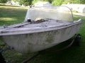
1969 Stern Craft Boat 19' |

‘62 Dorsett Catalina( / Boats)


1967 Evinrude Sportsman boat, motor & trailer - $4,500( / Boats)


FiberGoogle
Who's Online
We have 5450 guests and no members online